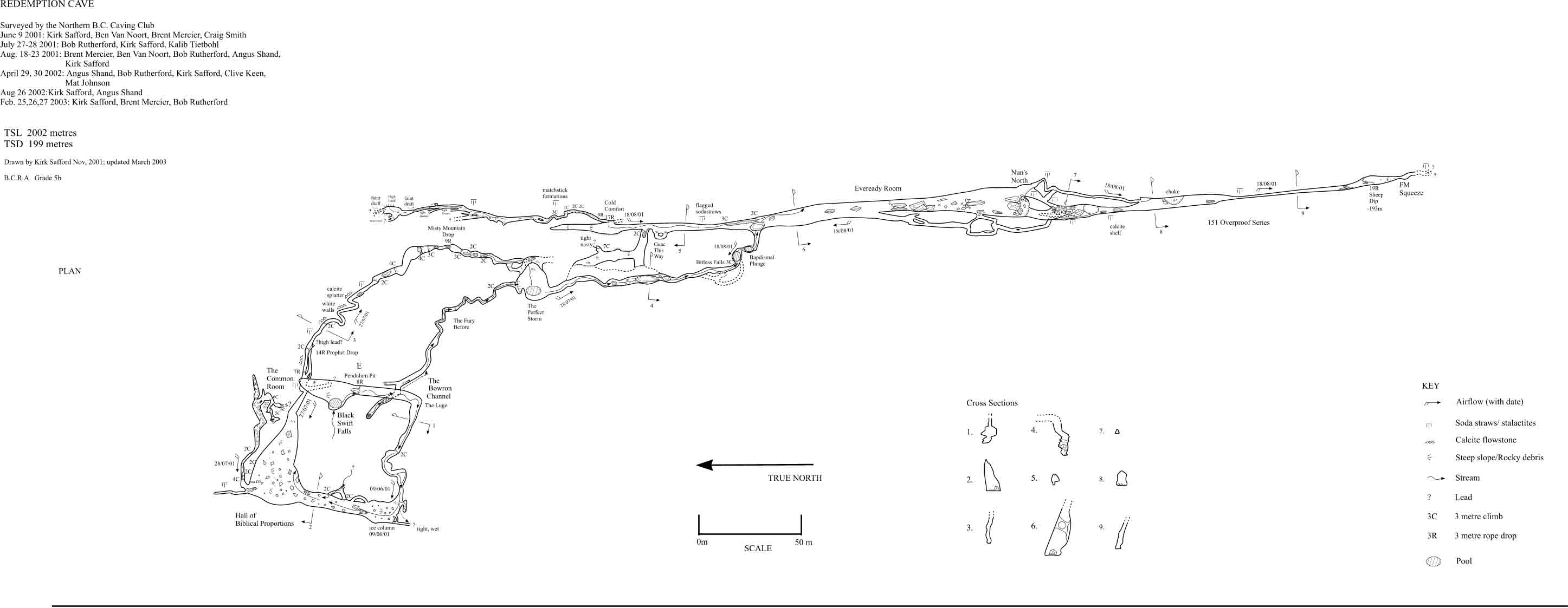
Cave surveying was conducted to British Cave Research Association (BCRA) grade 5b standards (horizontal and vertical angles accurate to plus or minus 1 degree; distances accurate to plus/minus 10 cm). Length and depth surveyed was determined, and then compared with surface topography. Mapping for this project provided relative locations of formations, photomonitoring sites, insect collecting sites and other cave attributes (such as air currents, passage dimensions, promising leads etc). Areas more sensitive to impacts and the types of impacts expected could then be assessed and planned for.
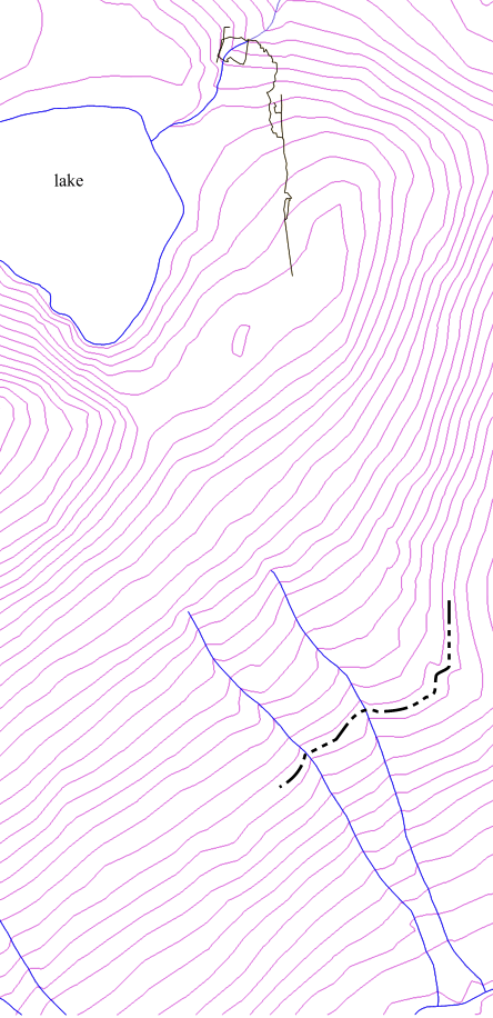 |
Knowing the geography of an area is important for any management decisions. Similarly, knowing the location of a cave relative to the surface environment is essential since surface activities can impact the subsurface environment. It also can be a strong motivator for further effort into exploration. In this case it showed us that the cave was heading in an unexpected direction, through the whole ridge, and that we were far from midway through the ridge despite over a kilometre of surveyed passage from entrance to deepest point. It also showed that the cave system drains the lake, its tributaries AND probably drains components of the other side of the ridge. |
The invertebrate collection was conducted to record cave biodiversity, specifically to document species use and determine whether there are any cave adapted taxa. The cave may provide unique environmental conditions which can influence invertebrate distribution and abundance.
Invertebrates were collected by pitfall traps, dipnetting, light traps, and aquatic traps in two intensive collection efforts (August 2002, February 2003) and a third small collection by hand (April 2002). In August, five unbaited pitfall traps were positioned at intervals from 200 metres from the entrance through to the Eveready Room (up to 750 metres in). Six dipnetting stations in total were sampled in August, one on the surface upstream from the entrance and five underground down to where the stream disappears. This allowed some comparison of underground and surface stream fauna. In February, seven baited pifall traps were placed 200 metres from the entrance, and from approximately 700 (Eveready Room) to 900 metres (151 Overproof Series). Four baited aquatic traps were also used in winter. Woody debris and mycelium were collected in winter far above the present waterline 200 metres into the cave. The material was put through a Burlese funnel, which netted mostly mites and, surprisingly, a couple of flies (diptera) in families not found in August.
The light trap was placed in two locations, at 200 and 650 metres from the entrance, near the stream in August. A Petzel Tika lamp was used as the light source, which burned continuously for the 96 hours the trap was in the cave. The light trap is an unusual method as cave-adapted fauna generally don't have eyes and wouldn't be caught by this trap, however this trap succeeded in collecting many diptera that had completed their lifecycle from larvae to adult in the cave.
|
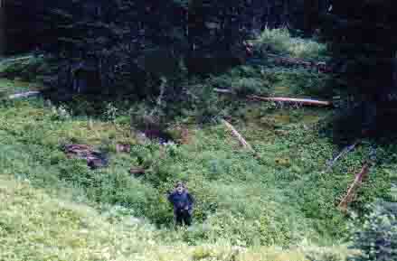
In a karst landscape, water is drained underground and the objective of this component of the project was to look for surface features that indicated the extent of the drainage system for the cave. Since the cave was formed in a limestone band in the ridge, the goal was to determine the boundaries of the limestone unit and document surface karst features. The majority of the cave watershed is on the surface above the lake which drains into the cave, though some subsurface drainage on the south side of the ridge is likely. So far there have not been significant amount of karst features found (the photo is one exception), which is not suprising given the impact of past glaciations which scour surface karst. Although the cave hasn't been dated, it is probably much older than recent glaciations; other caves in the Rocky Mountains are probably at least 350,000 yrs old (Gadd 1995). |
|
| Photo Clive Keen |
Photomonitoring and Photo-documentation Procedure
Permanent photomonitoring stations were set up at locations in the cave where damage to formations was possible, and where evidence of use could be visualized. In future years, the exact photos will be repeated and will show any damage or colour changes to formations. A logbook has been placed in the cave as a voluntary record of visitors, allowing comparsion of impacts and number of visitors.
Hilti bolts were placed in the wall at stations, and a 1/4" threaded rod, acting as a monopod, was screwed into the bolt. A camera dedicated to photomonitoring was screwed into the other end of the rod and positioned to take the photo. Compass and inclinometer readings were taken in the direction of the photo and recorded. A rod bent at 45 degrees and one at 90 degrees allowed a full range of angles to photographed, and more than one photo to be taken at each station.
In locations where stations could not be placed (i.e. wall substrate wouldn't hold a bolt), features were photo-documented by hand without a specific reference point.
References
Gadd, B. 1995. Handbook of the Canadian Rockies. DogKnows Publishing. Corax Press, Jasper, Alberta, Canada. 550-551 pp.
Zacharda, Miloslav, Chris W. Pugsley. 1988. Robustocheles occulta sp.n., a new troglobitic mite (Acari: Prostigmata: Rhagidiidae) from North American caves. Can. J. Zool. Vol. 66. pp.646-650.
|
The Crew Mappers: Kirk Safford, Bob Rutherford, Ben Van Noort, Angus Shand, Brent Mercier, Clive Keen, Kalib Tietbohl, Mat Johnson, Craig Smith Scoopers and Diggers: Lance and Sue Amos, Erin Evans, Trevor Joyce, Barry Vilac, Jarvis Walker, Pepper the dog, and apologies to others regretfully (and absent mindedly) forgotten. |
Project Summary/ Project
History/ The Cave (formations)/ Biodiversity/
Mapping/ Invertebrate collection/
Surface Karst Exploration/
Photomonitoring
Northern B.C. Caving Club 2003
Updated September 2003